Hotan Prefecture[10] (see also § Etymology) is located in the Tarim Basin region of southwestern Xinjiang, China, bordering the Tibet Autonomous Region to the south and Union Territory of Ladakh and Gilgit-Baltistan to the west. The vast majority of the Aksai Chin region which is disputed between China and India is administered as part of Hotan Prefecture. The seat of Hotan Prefecture is Hotan and its largest county by population is Karakax County. The vast majority of the residents of the prefecture are Muslim Uyghurs and live around oases situated between the desolate Taklamakan Desert and Kunlun Mountains.
The region was the center of the ancient Iranian Saka Buddhist Kingdom of Khotan. Later, the region was part of the Kara-Khanid Khanate, followed by the Qara Khitai, Chagatai Khanate, Moghulistan and the Dzungar Khanate, which was conquered by the Qing dynasty of China. Hotan became part of Xinjiang under Qing rule.[11] The prefecture is known for its jade, silk and carpets.
Etymology
Hotan Prefecture is named for its seat, Hotan (or Khotan). The area was originally known as Godana in ancient Sanskrit cosmological texts.[12] The Chinese transcribed the name as 于窴, pronounced Gudana in Middle Chinese (Yutian in modern Standard Chinese); the pronunciation eventually morphed into Khotan. In the 7th century, the Chinese Buddhist monk and scholar Xuanzang attempted to remedy this lexical change. Xuanzang, who was well-versed in Sanskrit, proposed that the traditional name was in fact Kustana (गौस्तन) and asserted it meant “breast of the Earth”. However, this was likely borrowed from the Tibetan name for the region, Gosthana, which means “land of cows”. It is therefore most likely that the original name of Hotan was Sanskritic in origin, a consequence of ancient Indian settlement in the area.[13][14]
The official Uyghur-Latin transliteration, and therefore English spelling, of the modern city’s name is “Hotan” according to the Register of Chinese Geographic Places.[15] The Hanyu pinyin romanization Hetian has also been used on some maps.
History
In 1755, the Qing Empire defeated the Dzungar Khanate. In 1759 (the 24th year of the Qianlong reign), an Imperial Resident (Amban) was established in Khotan, placed under the authority of the Resident in Yarkand, and the Baishan faction was completely suppressed. Under Qing rule, a small number of officials and troops were stationed in Khotan, serving as one of the bases for local administration. From the eighteenth to the nineteenth century, the population of Khotan gradually increased, and residential areas expanded beyond the old city walls. In 1828, a new city was constructed near the old city for defensive purposes.[16] The Hotan Prefecture region played a major part in the Dungan Revolt (1862–1877).[11]
In 1913, Hetian Directly Administered Subprefecture was reorganized as Hetian County. In 1915, Moyu County was established, carved out of Hetian County. In 1920, the Hetian Circuit was created. In 1928, it was restructured into the Hetian Administrative Region, with an Administrative Commissioner’s Office established.[17] In 1929, Cele County was established. In 1943, the Hetian Administrative Region was reorganized as Hetian Special District, with an Inspectorate Commissioner’s Office set up. In 1947, Minfeng County was established.[18]
On 22 December 1949, PLA forces reached Hotan. In 1950, the area was redesignated as Hotan District (和闐專區).[19] In 1959, the Chinese character name of Hotan was changed from ‘和阗‘ to the homophonous ‘和田‘.[20][21] In 1962, events of the Sino-Indian War occurred in parts of Aksai Chin administered as part of Hotan Prefecture. In 1971, Hotan was changed from a district (专区) to a prefecture (地区).[19] In 1977, the Hotan Prefecture Administrative Office was established. In 1979, the Hotan Administrative Office was created. In September 1983, Hotan City was established, carved out of Hotan County.[22]
In 2016, Kunyu was established within the boundaries of Hotan Prefecture. In December 2024, the State Council approved the establishment of He’an County and Hekang County, to be administered by Hotan Prefecture.[23]
Geography
The vast majority of the residents live around oases situated between the desolate Taklamakan Desert and Kunlun Mountains. To the north, the prefecture borders Aksu Prefecture, to the east Bayingolin Mongol Autonomous Prefecture, to the west Kashgar Prefecture, and to the south, Tibet and the areas disputed between China, India and Pakistan. Aksai Chin includes the southernmost point administered as part of Xinjiang. Most of the prefecture has a cold desert climate.
Hotan Prefecture contains 36 rivers of varying sizes, including the Andir River, Niya River, Keriya River, Cele River, Yurungkash River, Karakash River, Sangzhu River, Pishan River, Galwan River, Tiannan River, Changlong River, Salijilganxi River, and Chip Chap River, with a total annual runoff of 7.4 billion cubic meters.[24]
These rivers exhibit extreme seasonal variation: flooding is common in summer, while severe drought occurs in autumn and winter, and water is especially scarce in spring, with only about 7% of the annual runoff occurring in April–May. Most rivers in Hotan Prefecture are inland (endorheic) rivers. They can generally be divided into five inland drainage basins: Pishan, Hotan–Moyu–Lop, Cele–Yutian–Minfeng, and the Qiangtang Plateau lake region. In addition, there is an outflow basin belonging to the Indian Ocean system, represented by the Chip Chap River, with an annual outflow of 293 million cubic meters. In the plains area, there are 36 rivers in total, of which 30 are utilized for irrigation and for drinking water for both humans and livestock.[25]
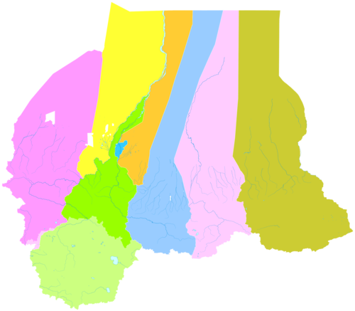
Administrative divisions


The Hotan Prefecture is divided into one county-level city and seven counties and surrounds Kunyu:[26][2]
←1
2
3
4
5
6
7
8
9
10
| |||||||||
| # | Name | Uyghur (UEY) | Uyghur Latin (ULY) | Chinese (S) | Hanyu Pinyin | Population (2020) | Area (km2) | Density (/km2) | |
|---|---|---|---|---|---|---|---|---|---|
| 1 | Hotan[10] (Hetian) | خوتەن شەھىرى | Hoten Shehiri | 和田市 | Hétián Shì | 501,028 | 466 | 1074.15 | |
| 2 | Hotan County[10] (Hetian) | خوتەن ناھىيىسى | Xoten Nahiyisi | 和田县 | Hétián Xiàn | 324,603 | 41,080[b] | 7.90 | |
| 3 | Karakax County[10] (Moyu) | قاراقاش ناھىيىسى | Qaraqash Nahiyisi | 墨玉县 | Mòyù Xiàn | 571,648 | 25,608 | 22.32 | |
| 4 | Pishan County[10] (Guma) | گۇما ناھىيىسى | Guma Nahiyisi | 皮山县 | Píshān Xiàn | 281,573 | 39,463 | 7.14 | |
| 5 | Lop County (Luopu) | لوپ ناھىيىسى | Lop Nahiyisi | 洛浦县 | Luòpǔ Xiàn | 286,900 | 14,114 | 20.33 | |
| 6 | Qira County (Chira, Cele) | چىرا ناھىيىسى | Chira Nahiyisi | 策勒县 | Cèlè Xiàn | 157,792 | 31,592 | 4.99 | |
| 7 | Keriya County (Yutian[10]) | كېرىيە ناھىيىسى | Kériye Nahiyisi | 于田县 | Yútián Xiàn | 257,038 | 39,033 | 6.59 | |
| 8 | Niya County (Minfeng[10]) | نىيە ناھىيىسى | Niye Nahiyisi | 民丰县 | Mínfēng Xiàn | 42,649 | 56,703 | 0.75 | |
| 9 | He’an County[27] | قىزىليۇلغۇن (خېئەن) ناھىيىسى | Qizilyulghun (Xé’en) Nahiyisi | 和安县 | Hé’ān Xiàn | ||||
| 10 | Hekang County[27] | شەيدۇللا (خېكاڭ) ناھىيىسى | Sheydulla (Xékang) Nahiyisi | 和康县 | Hékāng Xiàn | ||||

Demographics
| Year | Pop. | ±% p.a. |
|---|---|---|
| 2000 | 1,681,310 | — |
| 2010 | 2,014,362 | +1.82% |
| 2015 | 2,324,287 | +2.90% |
| [5][28] | ||
As of 2015, 2,248,113 (96.7%) of the 2,324,287 residents of the prefecture were Uyghur, 71,233 were Han Chinese (3.1%) and 4,941 were from other ethnic groups.[28]
In 2014, according to a local government employee in the township of Langru in Hotan County, “Islamic beliefs are very strong” in the prefecture.[7]
As of the 2000s, the population of Hotan Prefecture was more than 95% Uyghur.[5][6][7][8]: 178
As of 1999, 96.9% of the population of Hotan (Hetian) Prefecture was Uyghur and 3.1% of the population was Han Chinese.[29]
Residents of Hotan Prefecture commonly speak Uyghur and often do not speak Mandarin Chinese.[8]: 181 [30][31][32]: 241 [better source needed]
Notable persons
- Ismail Amat, former Chairman (Governor) of Xinjiang
- Islam Akhun, con-man
- Juma Tayir, imam of the Id Kah Mosque, murdered by ETIM terrorists
- Kurban Tulum, Member of the Fourth National People’s Congress, a symbol of unity between Han people and the Uyghurs
- Ablajan Awut Ayup, a pop singer, songwriter and dancer
- Abdul Haq al-Turkistani, militant
Historical maps
Historical English-language maps including modern-day Hotan Prefecture area:
-
 Map including ILCHÍ (1865)
 -
 Map of the expeditions of Sven Hedin (1906-8) including the southern part of the modern Hotan Prefecture (RGS, early 20th century)
 -
 Map including Hotan (labeled as Khotan) (1917)
 -
![Map including most of northern Hotan Prefecture area (USATC, 1971)[c]](https://upload.wikimedia.org/wikipedia/commons/thumb/0/00/Txu-oclc-6654394-nj-44-3rd-ed.jpg/250px-Txu-oclc-6654394-nj-44-3rd-ed.jpg)
-
![From the Operational Navigation Chart; map including Hotan Prefecture area (DMA, 1980)[d]](https://upload.wikimedia.org/wikipedia/commons/thumb/f/fb/Operational_Navigation_Chart_G-7%2C_6th_edition.jpg/500px-Operational_Navigation_Chart_G-7%2C_6th_edition.jpg)
-
![Map including Hotan Prefecture area (northwest) (DMA, 1984)[e]](https://upload.wikimedia.org/wikipedia/commons/thumb/a/a1/Txu-pclmaps-oclc-22834566_g-7a.jpg/500px-Txu-pclmaps-oclc-22834566_g-7a.jpg)
-
![Map including Hotan Prefecture area (northeast) (DMA, 1990)[f]](https://upload.wikimedia.org/wikipedia/commons/thumb/2/26/Txu-pclmaps-oclc-22834566_g-7b.jpg/500px-Txu-pclmaps-oclc-22834566_g-7b.jpg)
-
![Map including Hotan Prefecture area (southwest) with Aksai Chin (DMA, 1995)[g]](https://upload.wikimedia.org/wikipedia/commons/thumb/e/ee/Txu-pclmaps-oclc-22834566_g-7d.jpg/330px-Txu-pclmaps-oclc-22834566_g-7d.jpg)


![Map including most of northern Hotan Prefecture area (USATC, 1971)[c]](https://shirtaphobia.com/?rdp_we_resource=https%3A%2F%2Fen.wikipedia.org%2Fwiki%2FFile%3ATxu-oclc-6654394-nj-44-3rd-ed.jpg)
![From the Operational Navigation Chart; map including Hotan Prefecture area (DMA, 1980)[d]](https://shirtaphobia.com/?rdp_we_resource=https%3A%2F%2Fen.wikipedia.org%2Fwiki%2FFile%3AOperational_Navigation_Chart_G-7%2C_6th_edition.jpg)
![Map including Hotan Prefecture area (northwest) (DMA, 1984)[e]](https://shirtaphobia.com/?rdp_we_resource=https%3A%2F%2Fen.wikipedia.org%2Fwiki%2FFile%3ATxu-pclmaps-oclc-22834566_g-7a.jpg)
![Map including Hotan Prefecture area (northeast) (DMA, 1990)[f]](https://shirtaphobia.com/?rdp_we_resource=https%3A%2F%2Fen.wikipedia.org%2Fwiki%2FFile%3ATxu-pclmaps-oclc-22834566_g-7b.jpg)
![Map including Hotan Prefecture area (southwest) with Aksai Chin (DMA, 1995)[g]](https://shirtaphobia.com/?rdp_we_resource=https%3A%2F%2Fen.wikipedia.org%2Fwiki%2FFile%3ATxu-pclmaps-oclc-22834566_g-7d.jpg)
Notes
- ^ includes areas in Aksai Chin
- ^ includes areas in Aksai Chin
- ^ From map: “DELINEATION OF INTERNATIONAL BOUNDARIES MUST NOT BE CONSIDERED AUTHORITATIVE”.
- ^ From map: “The representation of international boundaries is not necessarily authoritative.”
- ^ From map: “The representation of international boundaries is not necessarily authoritative”
- ^ From map: “The representation of boundaries is not necessarily authoritative.”
- ^ From map: “The representation of boundaries is not necessarily authoritative.”
Footnotes
- ^ 夏征农; 陈至立, eds. (September 2009). 辞海:第六版彩图本 [Cihai (Sixth Edition in Color)] (in Chinese (China)). Shanghai: Shanghai Lexicographical Publishing House. p. 0866. ISBN 978-7-5326-2859-9.
和田 1市名。{…}和田地区行署驻此。{…}清设和阗直隶州,1913年改和阗县,1959年改和田县。
- ^ a b 行政区划 [Administrative Divisions]. Hotan Prefecture People’s Government. 19 January 2018. Retrieved 23 January 2020.
和田地区辖和田市、和田县、皮山县、墨玉县、洛浦县、策勒县、于田县、民丰县7县1市,91个乡镇,13个街道办事处,98个社区,1384个行政村,还有生产建设兵团十四师及所属奴尔牧场、47团场、皮山农场及224团场。历任中共和田地委书记22位,专员14位,现任地委书记杨发森、行署专员艾则孜•木沙。
- ^ “《和田地区土地利用总体规划(2010-2020年)》”. 和田地区国土资源局.
{{cite web}}: Missing or empty|url=(help) - ^ 国务院第七次全国人口普查领导小组办公室 (July 2022). 王萍萍 (ed.). 中国人口普查分县资料—2020. China Statistics Press. ISBN 978-7-5037-9772-9.
- ^ a b c 和田地区历史沿革 [Hotan Prefecture Historical Evolution]. XZQH.org (in Simplified Chinese). 1 December 2014. Retrieved 21 January 2020.
2000年第五次人口普查,和田地区常住总人口1681310人。{…}2000年末,和田地区常住总人口168.15万,其中非农业人口23.67万人,占总人口的14.08%;维吾尔族162.56万人,占总人口的96.67%。{…}2003年,和田地区总面积248945.29平方千米,{…}2010年第六次人口普查,和田地区常住总人口2014362人,
- ^ a b 1997年和田地区行政区划. XZQH.org (in Simplified Chinese). 17 February 2011. Archived from the original on 30 October 2019. Retrieved 24 March 2020.
维吾尔族占96.9%,汉族占2.9%。
- ^ a b c Richard Finney, Jelil Kashgari and Erkin Tarim (17 December 2014). “Uyghurs Face Seizure of Land, Personal Property Under Tough New Rules”. Translated by Eset Sulaiman. Radio Free Asia. Archived from the original on 22 December 2019. Retrieved 18 January 2020.
Government employees at the local level frequently regret the difficulties caused by these requirements, an employee at Langru’s Economy Management Office told RFA, adding, “But we have no choice, since these are the rules of our county.” Hotan prefecture, in which the county lies, “is a very special region in the [Xinjiang] Autonomous Region,” he said. “Most of our population here are Uyghurs, and their Islamic beliefs are very strong.”
- ^ a b c Colin Legerton; Jacob Rawson (2009). Invisible China: A Journey Through Ethnic Borderlands. Chicago Review Press. pp. 178, 181. ISBN 978-1-55652-814-9 – via Internet Archive.
While much of Xinjiang is being overpopulated by Han migration from eastern China that has more than quadrupled the desert region’s population in a mere half-century, Hotan has been protected from the influx by its remote location at the southern base of the Taklimakan. It remains more than 95 percent Uyghur.{…}Even after eight years in the city, he spoke only Uyghur. His few Han clients were forced to communicate in their limited Uyghur, he explained, as he himself had never learned Chinese. In Hotan, there was no need for it.
- ^ “2021年和田地区国民经济和社会发展统计公报” (in Chinese). 19 April 2022. Retrieved 21 April 2022.
- ^ a b c d e f g The official spelling is “Hotan” according to 中国地名录. Beijing: SinoMaps Press (中国地图出版社). 1997. p. 304. ISBN 7-5031-1718-4.
- ^ a b “Hotan”. Encyclopædia Britannica. Archived from the original on 25 August 2019. Retrieved 24 January 2020.
- ^ Higgins, Benjamin (November 1962). “The Philippines. Public Policy and National Economic Development. By Frank Golay. Ithaca: Cornell University Press, 1961. Xviii, 455. Map, Tables, Index, Bibliographic Essay”. The Journal of Asian Studies. 22 (1): 114–116. doi:10.2307/2049929. JSTOR 2049929.
- ^ Wang, Bangwei; Sen, Tansen (2011). India and China: Interactions through Buddhism and Diplomacy: A Collection of Essays by Professor Prabodh Chandra Bagchi. Anthem Press. p. 186. ISBN 9780857288219.
- ^ Puri, Baij Nath (1987), Buddhism in Central Asia, Motilal Banarsidass, p. 52, ISBN 978-81-208-0372-5
- ^ (中国地名录, published in Beijing, SinoMaps Press 中国地图出版社 1997; ISBN 7-5031-1718-4; p. 312.)
- ^ Altanvcir; 阎芳 (2000). 清代新疆军府制职官传略 (in Chinese). 黑龙江敎育出版社. p. 5. ISBN 978-7-5316-3777-6. Retrieved 31 March 2026.
- ^ 于维成 (2005). 新疆地名与建制沿革 (in Chinese). 新疆人民出版社. p. 111. ISBN 978-7-228-09431-8. Retrieved 31 March 2026.
- ^ 朱培民 (2008). 新疆与祖国关系史论 (in Chinese). 新疆人民出版社. p. 223. ISBN 978-7-228-12092-5. Retrieved 31 March 2026.
- ^ a b 历史沿革 (in Simplified Chinese). Hotan Prefecture People’s Government. 19 January 2019. Retrieved 22 January 2020.
1949年12月22日中国人民解放军十五团抵达和阗 ,和阗解放。1950年改称和阗专区,1959年改和阗为和田,1971年改专区为地区,1979年建立和田行政公署。
- ^ 劉學銚 (1 July 2014). 正視紛爭下的新疆問題 (in Chinese). 思行文化. p. 83. ISBN 978-986-5681-12-8. Retrieved 31 March 2026.
- ^ 和田简史 (in Chinese). 中州古籍出版社. 2002. p. 260. ISBN 978-7-5348-1821-9. Retrieved 31 March 2026.
- ^ 新疆通志 (in Chinese). 新疆人民出版社. p. 314. Retrieved 31 March 2026.
- ^ “新疆维吾尔自治区新设和安县、和康县 由和田地区管辖”. 新闻频道_央视网(cctv.com) (in Chinese). 27 December 2024. Retrieved 31 March 2026.
- ^ 邓英淘; 王小强; 崔鹤鸣 (2001). 西部大开发方略: 再造中国续篇 (in Chinese). 文匯出版社. p. 410. ISBN 978-7-80531-913-1. Retrieved 31 March 2026.
- ^ 中国边疆史地论集: 续编 (in Chinese). 黑龙江敎育出版社. 2003. p. 212. ISBN 978-7-5316-3810-0. Retrieved 31 March 2026.
- ^ 2018年统计用区划代码和城乡划分代码:和田地区 [2018 Statistical Area Numbers and Rural-Urban Area Numbers: Hotan Prefecture] (in Simplified Chinese). National Bureau of Statistics of the People’s Republic of China. 2018. Retrieved 23 January 2020.
统计用区划代码 名称 653201000000 和田市 653221000000 和田县 653222000000 墨玉县 653223000000 皮山县 653224000000 洛浦县 653225000000 策勒县 653226000000 于田县 653227000000 民丰县
- ^ a b “Two new counties established in Xinjiang”. Xinhuanet. 27 December 2024. Retrieved 27 December 2024.
- ^ a b 3–7 各地、州、市、县(市)分民族人口数 (in Simplified Chinese). Statistic Bureau of Xinjiang Uygur Autonomous Region. Archived from the original on 11 October 2017. Retrieved 3 September 2017.
- ^ Morris Rossabi, ed. (2004). Governing China’s Multiethnic Frontiers (PDF). University of Washington Press. p. 180. ISBN 0-295-98390-6. Archived (PDF) from the original on 7 January 2020. Retrieved 4 May 2020.
- ^ Peter Neville-Hadley (1997). China the Silk Routes. Cadogan Guides. Globe Pequot Press. p. 304. ISBN 1-86011-052-5 – via Internet Archive.
Travelling east from Khotan{…}Many Uighurs speak no Chinese at all, and most hotels are even less likely to have English speakers than those elsewhere in China.
- ^ David Eimer (2014). The Emperor Far Away: Travels at the Edge of China. Bloomsbury USA. p. 75. ISBN 978-1-62040-363-1 – via Internet Archive.
Far fewer people understood Mandarin in Hotan than anywhere else I’d been in Xinjiang. It made getting around difficult, as not only did the taxi drivers fail to understand what I was saying, but they couldn’t read an address either. Most ignored or didn’t know the Chinese names given to the streets anyway.
- ^ 王炜, ed. (2004). Xin jiang 新疆 [Xinjiang] (in Simplified Chinese). Beijing: Encyclopedia of China Publishing House. pp. 235, 241. ISBN 7-5000-6883-2 – via Internet Archive.
和田地区{…}安全 因为与当地人语言交流可能有障碍,注意礼貌和当地习俗是非常必要,以免发生不必要的争执。
External links
- Hotan Government website (in Chinese)
- Hotan Government website (in Uyghur)
- Silk Road in Photographs > Khotan
37°07′N 79°55′E / 37.11°N 79.91°E